- Title
- SSF/MSF - Kephalonia: Water depth
- Abstract
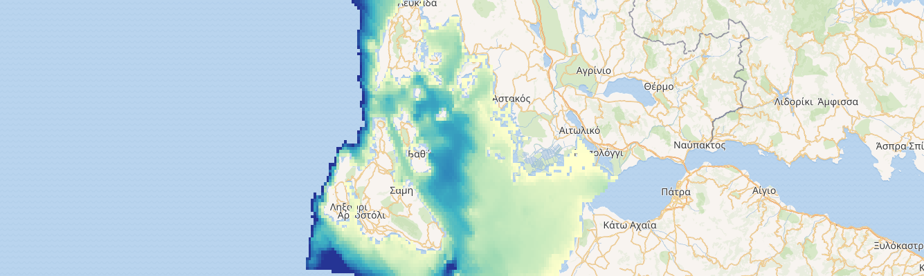
Bathymetry in meters around Kephalonia island - raster - WGS84
Bathymetric map comes from EMODNET http://www.emodnet-bathymetry.eu/
- License
- License not specified (Not specified)
-
+ The original author did not specify a license.
- Publication Date
- Feb. 24, 2020, 12:45 p.m.
- Type
- Raster Data
- Category
- Physical characteristics
- Physical characteristics
- Sub Category
- Bathymetry
- Bathymetry
- Regions
- Greece
- Approved
- Yes
- Published
- Yes
- Featured
- No
- Name
- admin
- SupportGAIR@regione.emilia-romagna.it
- Position
- None
- Organization
- Emilia-Romagna Region
- Location
- Bologna Italy
- Voice
- None
- Fax
- None
- Identification Image
-
- Spatial Extent
- ---
- Projection System
- EPSG:4326
- Extension x0
- 20.266989238983200
- Extension x1
- 21.504980885422100
- Extension y0
- 37.907900435910900
- Extension y1
- 38.912500214578600
- Maintenance Frequency
- Frequency Of Maintenance For The Data Is Not Known
- Language
- English
- Supplemental Information
No information provided
- Spatial Representation Type
- raster
- Name
- admin
- SupportGAIR@regione.emilia-romagna.it
- Position
- None
- Organization
- Emilia-Romagna Region
- Location
- Bologna Italy
- Voice
- None
- Fax
- None
- Link Online
- /layers_ext/geonode:bathymetry
- Metadata Page
- /layers_ext/geonode:bathymetry/metadata_detail
- OGC WMS: geonode Service
- Geoservice OGC:WMS
- OGC WCS: geonode Service
- Geoservice OGC:WCS
- Name
- admin
- SupportGAIR@regione.emilia-romagna.it
- Position
- None
- Organization
- Emilia-Romagna Region
- Location
- Bologna Italy
- Voice
- None
- Fax
- None
- Domain areas
- Greek Ionian Sea
- Data portal
- EMODnet Bathymetry
- Data accessibility
- ACCESSIBLE
- Validation level
- official